Last Updated on: 13th May 2026, 02:06 pm
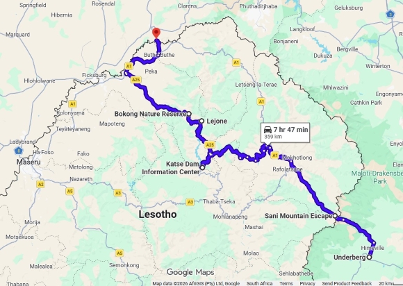
We drove from Underberg, up Sani Pass, and through Lesotho visiting Katse Dam, at the end of March.
Day 1: Underberg to Sani Top
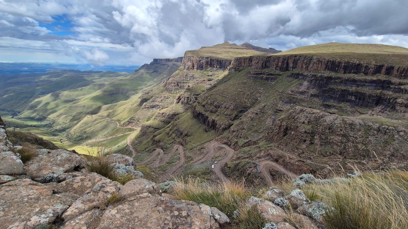
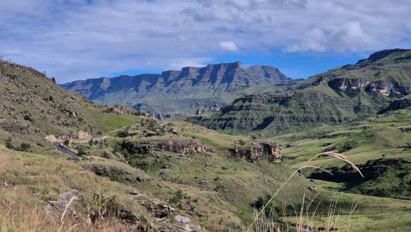
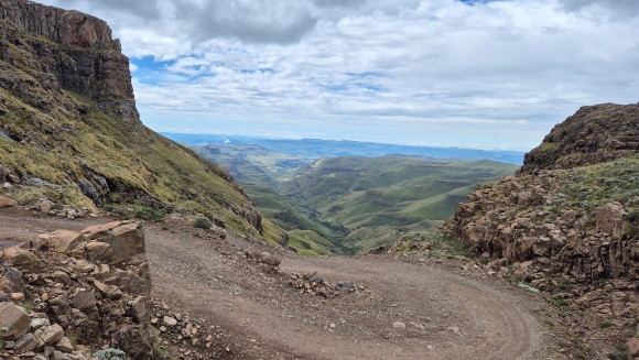
Driving up Sani Pass
Sani Pass is iconic because it goes directly up the formidable Drakensberg escarpment from South Africa into Lesotho and has wonderful views.
Sani Pass is entirely in South Africa, but the South African Border Control is at the bottom of the pass for practical reasons. The Lesotho Border Control is at the top. The road between the border posts is a gravel road and a 4×4 is required to negotiate the pass.
According to Google Maps, the South African border post is at elevation 1964 m and the Lesotho border post is at elevation 2876 m, a difference of 912 m. The distance between them is about 8 km.
It took us 1 hour 5 minutes (including photo stops) to get up the pass on a quiet morning with good weather conditions.
Some experienced 4×4 drivers told us that they find ascending the pass easier than descending.
(Mountain Passes South Africa[1] defines the start of the pass close to Underberg and the distance and elevation change by their definition is therefore greater than the core of the pass that I have noted above.)
Sani Top
As mountain weather is so changeable, I booked two nights at the lodge at the top of the pass (Sani Mountain Escape) to give us the best chance of enjoying a hike and taking in the scenery.
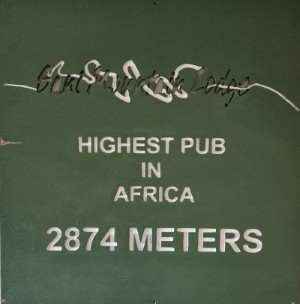
Many travellers however only stop at the lodge and visit the “highest pub in Africa” for a drink and / or meal.
(Tip: Sani Mountain Escape now requires an online booking for day visitors before allowing access.)
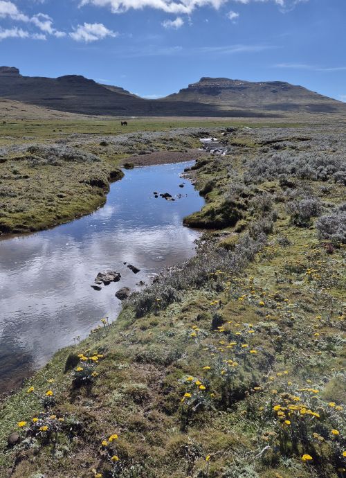
We went for a short walk on the lodge property to get better views of the pass.
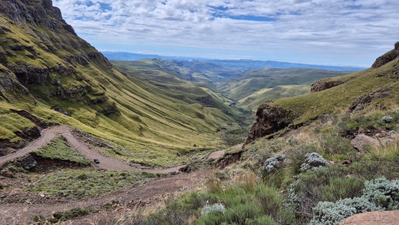
The weather forecast was good for the next morning. We visited reception and told the lodge that we were looking for a hike that would provide us with views down the escarpment from a different perspective. They recommended the Saddles Hike which was exactly what we had in mind.
It rained on and off in the afternoon, so we relaxed.
Day 2: Sani Top – Lesotho
The lodge allocated us a guide, and we set off on our hike at 08:30. Our good-natured guide was informative, and we very much enjoyed our walk.
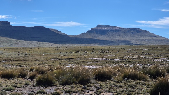
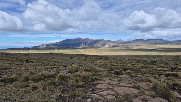
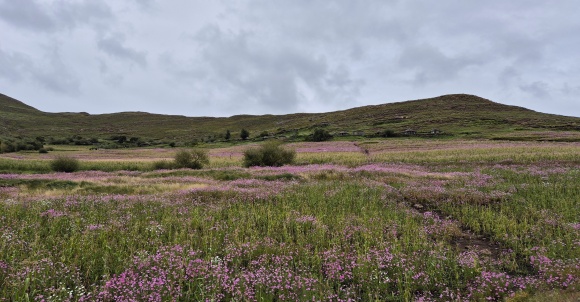
The route is mainly flat until you reach the saddles, but is uneven underfoot because of rocks, tufts of grass and waterlogged soil.
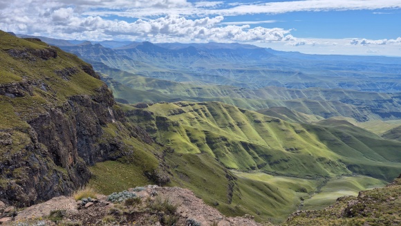
On the way back we walked towards the Sani Pass escarpment edge and looked down a few times.
We walked 8.9 km with a 190 m elevation gain.
If you are fit and up for a long hike, you can hike out-and-back to Thabana Ntlenyana (3482 m), the highest peak in southern Africa.
The mist rolled in this afternoon, accompanied by rain.
Day 3: Sani Top to Lejone – Lesotho
This morning we left the lodge at 09:00. We travelled towards Mokhotlong on the Kotisephola Pass, an impressive road. It is the second highest pass in Lesotho, with the highest point at 3242 m.
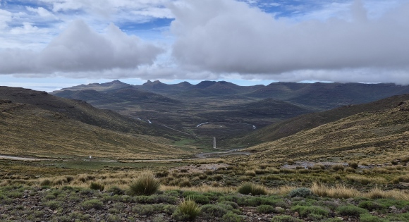
Many passes in Lesotho have very steep sections and you would have to know what you were doing if travelling in snowy / icy conditions.
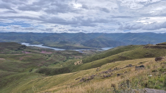
We did not go into Mokhotlong but continued on the A1 to Tlokoeng. From the point where we turned towards Tlokoeng, the road was pot-holed for a few kilometres. It was also from here that the landscape has been impacted by the construction camps and activities for the Lesotho Highlands Water Project Phase 2. The project involves new bridges (including the imposing Senqu River Bridge), resettlement villages, transfer tunnel and dam wall of the Polihali Dam.
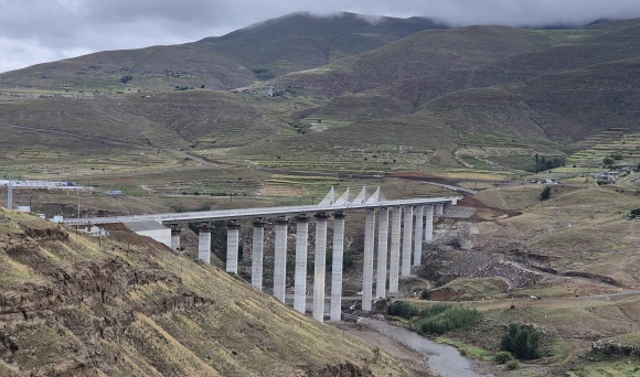
Senqu River Bridge is about 90 m high and has been built to span the new Polihali Dam.
Once you are passed the construction area, you will see the turn-off to the Senqu River viewpoint.
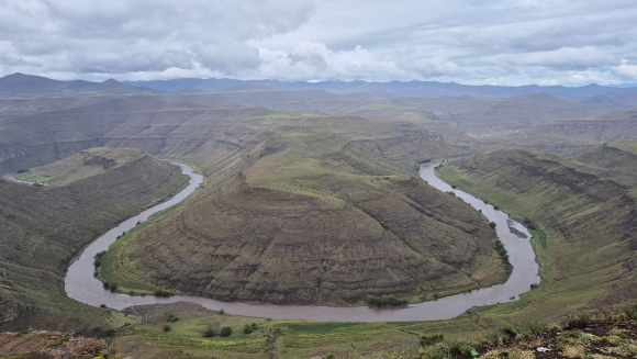
(There is another horseshoe bend on the Senqu River in southern Lesotho between Patlong and Seforong.)
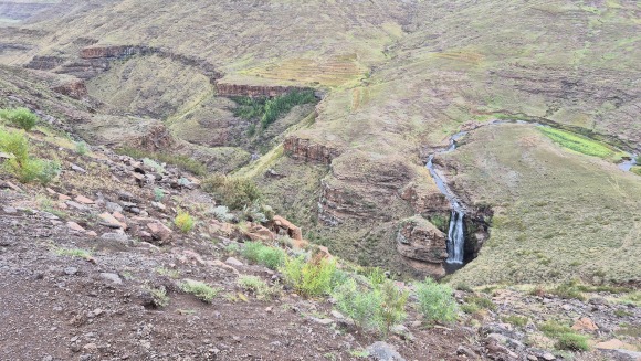
Ten minutes further is the Polihali Waterfall viewpoint.
We drove to the Katse Dam Information Centre.
Katse Dam Wall Tour
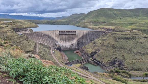
Katse Dam is a double-curvature concrete arch dam on the Malibamatso River in Lesotho. The dam wall is 185 m high and 710 m along its crest. It was constructed in Phase 1 of the Lesotho Highlands Water Project.
Many older South Africans remember the construction of this dam, which at its time was a momentous engineering project in the region. South Africans also appreciate that the Lesotho Highlands Water Project supplies Gauteng and other provinces with substantial amounts of additional water.
Tip: No drinks or snacks are for sale at the information centre.
The tour starts with a presentation at the information centre. The guide and security guard then proceed to a vehicle, and you follow them to the dam wall in your vehicle.
Once at the dam wall, you are given a hair cover and a hard hat. At the start, you walk on a grid over one of the bottom sluice gates, which is always open for environmental integrity. You then walk in one of the many tunnel walkways in the dam wall. It is quite cool inside the dam wall, so it is a good idea to bring a warm top. We found the tour interesting despite our lacklustre guide.
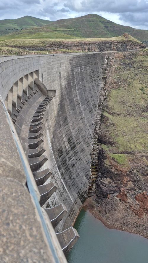
After that part of the tour, you head up to the road over the dam wall, and you can take photos from the top.
Our full tour took 1 ¼ hours, though I would imagine it may take longer if there are more people on the tour.
From the dam wall, we continued our journey to a lodge in Lejone.
Today we travelled 210 km in +- 5 ¼ hours i.e. at an average speed of about 40 km/h. The full route was tarred, and the roads were generally in good to excellent to condition. It is the winding nature of the route that slows you down (as well as some speed bumps in the construction area). By the time we reached Lejone, I had had enough of winding roads!
Day 4: Leave Lesotho through Caledonspoort Border Post
This morning our first stop was Bokong Nature Reserve for which there is an entrance fee. The chalets were being renovated or maintained and the guard told us that the restaurant will be re-opened around September 2026.
We caught a glimpse of the Lepaqoa Falls (60 m) before the mist closed in further.
Soon after leaving Bokong Nature Reserve, we reached the top of Mafika-Lisiu Pass (3090 m) and the viewpoint thereafter, which offers views of “the other side”. This is another remarkable pass and was built to facilitate the construction of the Katse Dam.
When we were there, it was very misty, so we didn’t stop. About 30 m lower, we were out of the mist but there was now nowhere to stop safely.
We decided to leave a visit to the Leribe dinosaur footprints for another time. There are two locations in this area: Subeng River and Tsikoane Village, which both seem to involve some adventuring.
We left Lesotho through the Caledonspoort Border Post, with plans to visit the Mountain Kingdom again.
References:
- https://www.mountainpassessouthafrica.co.za/find-a-pass/kwazulu-natal/410-sani-pass.html – retrieved April 2026
4 replies on “Self-drive Lesotho Sani Pass Katse Dam route”
Detailed research and super interesting route. Would love to follow it too one day.
Thank you Felicity
Beautiful writeup and very informative. We are planning Clarens to Afriski and then Katse Dam. How is the road from Tlokoeng to Katse as you leave the A1? Is it gravel or tarred and what’s the condition if it’s gravel? I understand there are 2 turns, did you take the Tlokoeng or the one after at Mapholaneng.
Thank you Ayanda. The road from Tlokoeng to Katse as you leave the A1 is tar all the way👍. We were coming from the opposite direction from you (from Sani Top), so took the Tlokoeng turn. I unfortunately don’t know what the turn off from Mapholaneng is like. Enjoy your trip!