Last Updated on: 28th April 2026, 09:52 pm
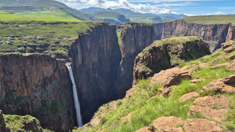
The beautiful Maletsunyane Falls is the main reason we visited Semonkong, “place of smoke”, but there is much more to experience.
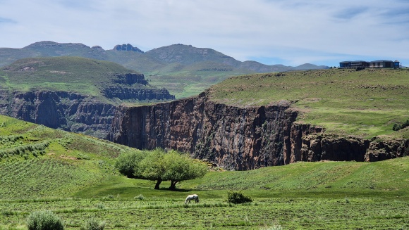
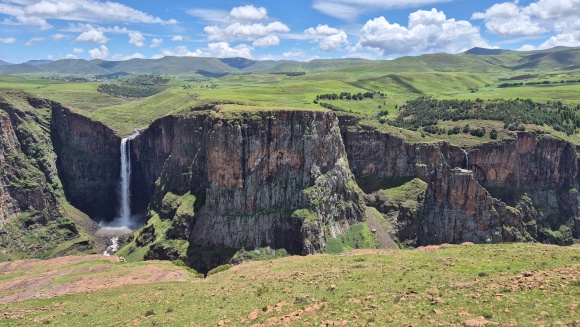
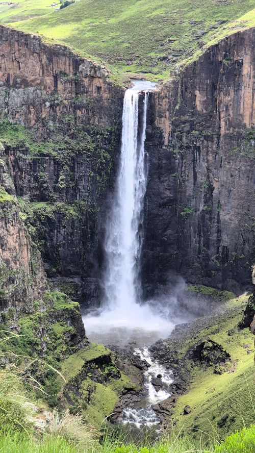
Maletsunyane Falls, at 192 m (630 ft), is one of the tallest single-drop waterfalls in Africa.
Getting to Semonkong
We entered Lesotho at the Maseru Bridge border post.
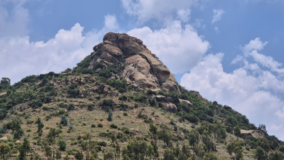
I wanted to visit The Lion Rock Mountain which is in a Maseru suburb. Google Maps kept directing us onto dirt roads to get into the suburb, but we persisted until we turned left onto a tar road. Close to the viewpoint, we turned onto a dirt road which was in poor condition. The best viewing orientations for this remarkable rock formation are from the east and northeast.
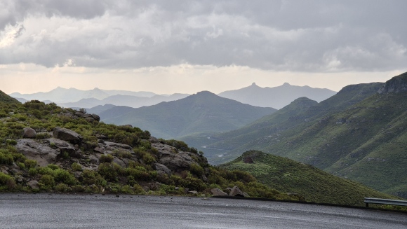
Lesotho, known as the Mountain Kingdom, has the highest lowest point of any country in the world (+- 1400 m). The highest point in Lesotho, and in southern Africa, is Thabana Ntlenyana at 3482 m.
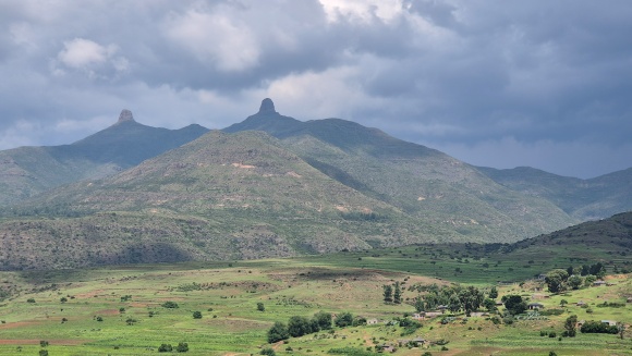
The roads to Semonkong, the A2 and A5, are tarred all the way and were generally in good condition. There were a few potholes on some of the passes, as well as some rocks which had fallen onto the road. If I remember correctly, we crossed three passes. The highest point reached on this route is +- 2750 m. Some of the roads are steep and you would have to know what you were doing if travelling in snowy / icy conditions.
We stayed at Semonkong Lodge which is situated at 2200 m (7218 ft). The road to the lodge through the commercial centre of the settlement was in poor condition, though 2×4 vehicles were managing to get through.
Activities at Semonkong
There are several hiking trails in the area as well as cycling routes. The lodge offers abseiling, pony trekking, fly fishing and community tours.
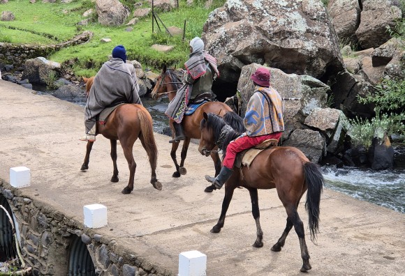
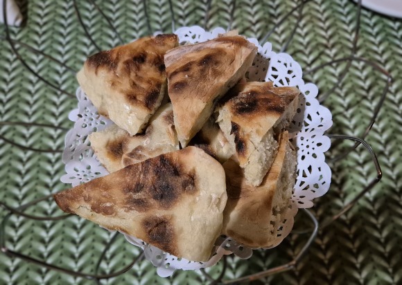
If you prefer to be more sedate, you can people watch from the lodge patio, as members of the community walk and ride past the front of the lodge. Even better, while enjoying delicious fresh liphaphata (pronounced diphaphata) – griddle-baked bread.
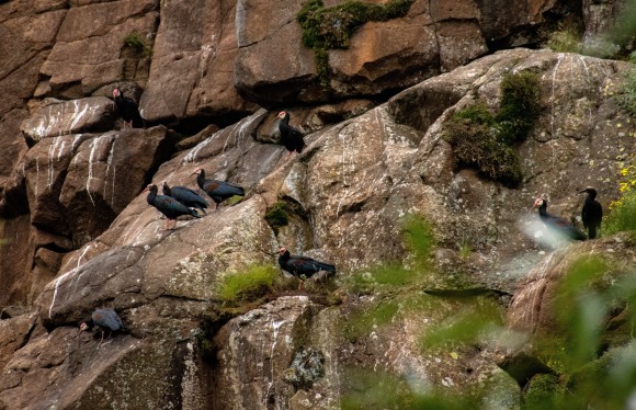
Birdwatchers will enjoy the opportunity to see the southern bald ibises which roost on the nearby cliffs.
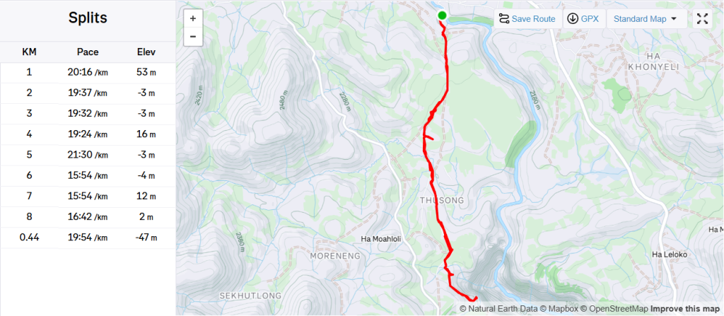
Hike from Semonkong Lodge to Maletsunyane Falls viewpoint
This walk is through the rural settlement in the Semonkong area. You walk along paths that are used by local people to get to and from their homes and the village centre.
There is a fee for viewing the falls. The lodge will inform you where to pay. When we were there, the payment allowed access for two days.
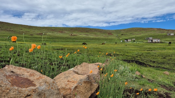
It is a lovely scenic walk, and you are exposed to Basotho rural life. We were there in summer (December), so the landscape was fresh and green. Some of the paths were however very muddy because of all the rain. The people we encountered displayed a range of friendliness: from extremely friendly to indifferent.
About two thirds of the way to the gorge, we were approached by children wanting to “guide” us. We explained that we did not need guiding and that we had no money with us. They were persistent and kept us company for quite some time until they accepted that their quest was going to be fruitless. I heard them reporting to their “handlers” (teenage boys), that we had no money with us. This happened again with another group of children. If I were to return, I would hire a guide through the lodge as this would provide someone with an income for the morning and he would hopefully discourage this behaviour.
Type of trail: Out-and-back
Distance: +- 8 km
Cumulative elevation gain: +- 250 m
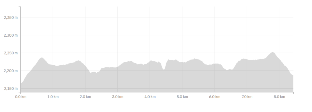
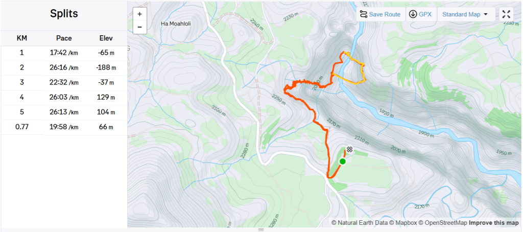
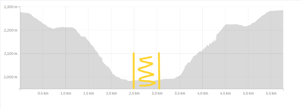
Hike from Information Centre to base of Maletsunyane Falls
The next day, we hiked down the gorge to the base of the Maletsunyane Falls. As recommended by the lodge, we hired a guide.
We decided not to repeat the walk to the gorge, so we drove to the Visitor Centre / Information Centre which overlooks the gorge. There is a toll gate where you pay an entrance fee. (If it is not staffed, then pay on your return.) This road also had sections in bad condition, though there were 2×4 vehicles getting through.
We walked from the visitor centre to the edge of the gorge and then down to the base of the falls. The path is steep, but it is the nature of the path that increases the slipping risk: there are some steep sections with no footholds.
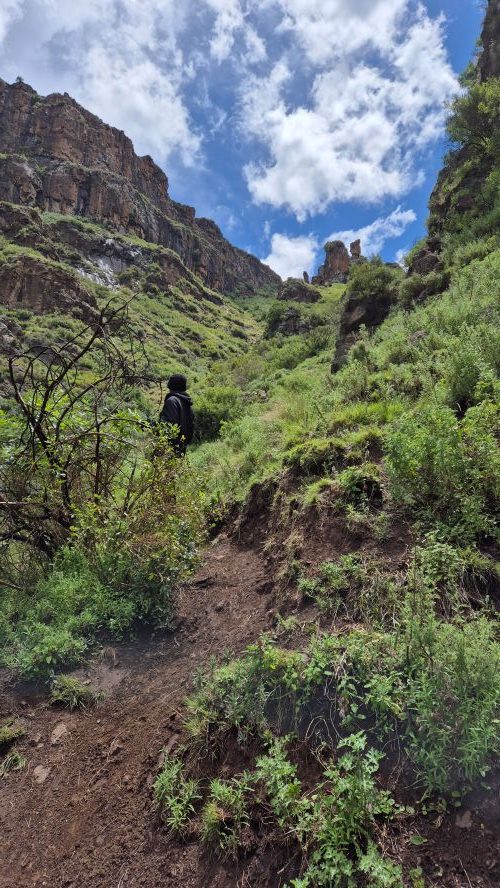
At the end of the path, you can make your way down over the wet rocks to get to the pool and have a swim.
Type of trail: Out-and-back
Distance: +- 5.2 km
Cumulative elevation gain: +- 290 m
Abseil Maletsunyane Falls
For those who do not have a fear of heights: this is the longest single-drop commercially operated abseil in the world, with a drop of 204 m (669 ft).

I joined as a spectator and enjoyed my packed breakfast, while vultures soared over the gorge.